Site information:
The Maroochy River estuary on the Sunshine Coast, located about 100 km north of Brisbane, is a popular bird watching spot. A variety of waders and terns are usually present at low tide on the sandbanks in the south channel of the river and although these can be viewed from both sides of the river, they are best viewed from the northern bank. Two of the best vantage points are near the swimming pool on the Esplanade at Cotton Tree and from Picnic Point Esplanade a little further north along the channel. High tide roost sites are located on the ocean beach, sand dunes, sandbanks and river estuary. At low tide, most waders are usually seen in the vicinity of Goat Island. As the river estuary is popular for swimming, fishing and other recreational activities, disturbance to the birds can be expected on the weekend and it is best to visit at other times. Use of a spotting scope is strongly recommended.
Species regularly observed here include Bar-tailed Godwit, Whimbrel, Eastern Curlew, Double-banded Plover (April – August), Red-necked Stint, Pied Oystercatcher and Red-capped Plover. The latter species breeds here between September and December. Pacific Golden Plover, sometimes numbering about 100, may be seen among the sand dunes. Occasionally, Terek Sandpiper, Grey-tailed Tattler, Curlew Sandpiper, Great Knot, Sooty Oystercatcher, Lesser Sand Plover and Greater Sand Plover are also seen. Beach Stone-curlew, listed as vulnerable in Queensland, is a possibility near the high tide debris on Goat Island.
How to get there: From Brisbane, drive north along the Bruce Highway for about 86 km. About 6 km beyond Palmview, take the Sunshine Motorway and follow it for about 14 km to the Maroochy River. To get to Cotton Tree, take the Bradman Avenue exit just before the bridge over the river, continue along this road until it merges with Duporth Avenue and then the Esplanade. To get to the northern bank of the river, take the David Low Way exit a little more than 1 km after the bridge. Shortly after leaving the motorway, turn right into Ocean Drive. Drive through several roundabouts, passing Nojoor Road and Twin Waters and then turn right into North Shore Road, a total distance of about 3 km. Park at the end of the road, walk through the trees to the river and then follow the river towards the ocean.
Site coordinates: Lat 26º 38’ 42” S, Long 153º 05’ 56” E (north shore).
Amenities/access: There is ample parking at all sites and toilet and picnic facilities are located at several places. The sites on the southern bank, but not those on the northern bank of the river, are easily accessible for disabled people.
Wader species: Bar-tailed Godwit, Whimbrel, Eastern Curlew, Terek Sandpiper, Grey-tailed Tattler, Curlew Sandpiper, Great Knot, Red-necked Stint, Beach Stone-curlew, Pied Oystercatcher, Pacific Golden Plover, Red-capped Plover, Double-banded Plover (March – August), Lesser Sand Plover and Greater Sand Plover.
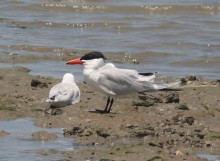
Other species: Caspian Tern, Lesser Crested Tern, Crested Tern, Common Tern and Little Tern.

