13-14th Feb 2021 Moreton Bay Shorebird Census
As a regular wader counter you may well be participating in our normal count on the weekend of 13-14th February. You, or one of your team will have been contacted by Linda Cross, the Count Coordinator. It is an important count as additional resources are available to cover more sites, primarily through the participation of Healthy Land and Water and DES/QPWS Marine Parks.
IF YOU CHOOSE, you can do more to assist by filling in additional information on the forms available from Healthy Land and Water (HLW). Regardless, we still need you to submit your bird data through the QWSG website as a normal count!
If you do submit the HLW form please supply information for Site Characteristics, Disturbance and Management on the form. No need to repeat the bird counts. If you do this, you must indicate to us (QWSG) that you have done so by mentioning it in the comments of the corresponding count entry that you make on the QWSG website.
You can send the HLW forms to Liz Gould, Healthy Land and Water, PO Box 13204, George Street Brisbane QLD 4003. You can also send the form by email to liz.g@hlw.org.au
Click to download a Word version of the HLW Survey Form the associated Survey Notes as a guide to filling out the form. The work HLW is conducting is designed to mitigate threats or otherwise improve conservation of migratory shorebirds. QWSG is supporting the work with provision of data and advice.
QWSG Surveys
Queensland Wader Study Group has undertaken a number of surveys counting waders on high tide roosts along almost the entire Queensland coast. Surveys have been undertaken since the early 1990s. These surveys have been funded by a wide range of agencies, including the Queensland Department of Environment and Resource Management, Burnett-Mary Regional Group, Natural Heritage Trust and WWF Australia. The surveys we have conducted to date are listed below, see our downloads page for copies of those reports.
| Survey | Period of survey |
| Airlie Beach to Cape Palmerston | 2003 – 2009 |
| Point Vernon to Tin Can Bay | 2005 |
| Tannum Sands to Point Vernon | 2006 – 2007 |
Future surveys
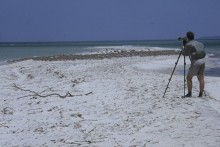
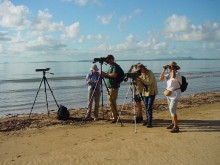
QWSG undertake regular surveys of different parts of the Queensland coast that have large wader populations. These surveys vary widely in the challenges surveyors face. They are open to people with an interest and knowledge of wader biology and field identification. Participants in surveys usually need to have a telescope and be moderately fit. Most surveys require some walking or boat travel to get to the counting site. People experienced in wader identification are especially appreciated. Surveyors are allocated one or more roosts to count each day and work in groups of 2 – 3, with one person counting and the other recording the data onto a count sheet. QWSG usually provides some reimbursement of fuel or other travel expenses for surveys more than 100 km from the counter’s home.
Planned Surveys: SE Gulf of Carpentaria March-April and October-November 2012 – contact David Milton for details.


